Filed Under Butte

Centerville Neighborhood, Butte

Butte National Historic Landmark District

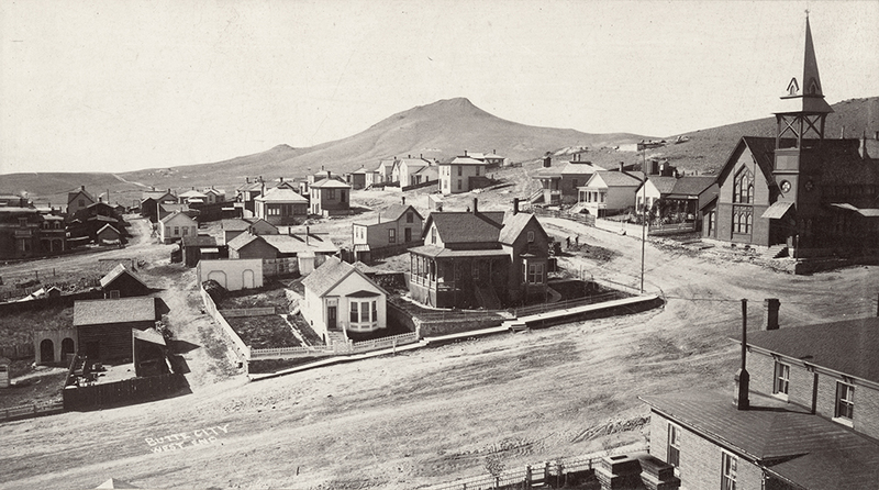
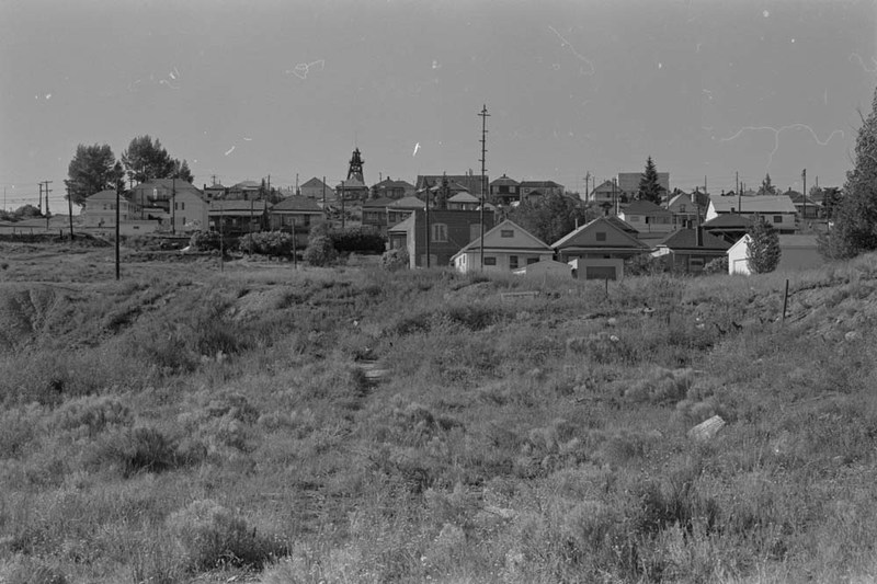
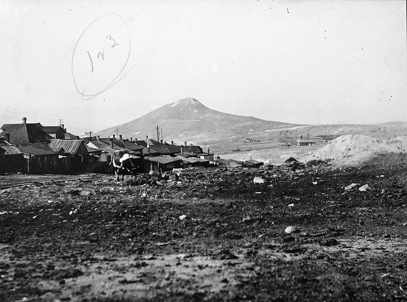
Tightly clustered wooden houses built into the steep slopes of the Butte Hill characterize Centerville. Mostly constructed before 1900, the small Queen Anne cottages, hipped-roof workers’ houses, and vernacular gable-roof homes primarily sheltered immigrant miners and their families. Head frames surrounded Centerville on all sides, and mining supported over three-quarters of the residents. Most homeowners leased the land upon which their houses sat from the Anaconda Company, which retained the right to reclaim the property to expand its mines. During the historic era, Centerville remained outside the city limits. As a result, the neighborhood also lacked city fire protection and street maintenance, further impeding development. Nevertheless, vibrant, ethnic strongholds developed, with cultural and occupational ties creating tightly knit communities amidst the industrial landscape. The neighborhood’s large Cornish population worshipped at Trinity Methodist Church (still extant) and gathered at the Sons of St. George Hall, now gone except its foundation. Cornish miners found work in copper king William A. Clark’s mines, among them the Mountain View, also known as the “Saffron Bun” for the large number of Cornishmen employed there. Centerville’s Irish immigrants also worked in nearby mines, like the legendary mile deep Mountain Con owned by Clark’s Irish rival, Marcus Daly. They fraternized at the Ancient Order of Hibernian Hall, formerly a block from the Sons of St. George. Local children attended the since demolished Adams School, Butte’s first public school. While the extensive collection of commercial and fraternal buildings that once lined Main Street are now gone, the many working-class residences continue to reflect the neighborhood’s rich history.

Images

Rear of West LaPlatte Street, Centerville.
Rear of West LaPlatte Street, Centerville. "Photo no. 123. Rear of West LaPlatte Street, Centerville." from "Report of Investigation of Sanitary Conditions in Mines, and of the Conditions Under Which the Miners Live in Silver Bow County" Lot 8 B1 5 11 Source: Montana Historical Society Research Center Photograph Archives, Helena, Montana Creator: Unidentified photographer Date: [1908-1912]
View of 20 O'Neill Street, Centerville
View of 20 O'Neill Street, Centerville "Photo no. 99 Another view of 20 O'Neill Street, Centerville." from "Report of Investigation of Sanitary Conditions in Mines, and of the Conditions Under Which the Miners Live in Silver Bow County" Lot 8 B1 5 04 Source: Montana Historical Society Research Center Photograph Archives, Helena, Montana Creator: Unidentified photographer Date: [1908-1912]
General catch-all, Centerville
General catch-all, Centerville "Photo no. 103. General catch-all in Centerville, natural drainage only sewer known." from "Report of Investigation of Sanitary Conditions in Mines, and of the Conditions Under Which the Miners Live in Silver Bow County" Lot 8 B1 5 08 Source: Montana Historical Society Research Center Photograph Archives, Helena, Montana Creator: Unidentified photographer Date: [1908-1912]
Butte City, West End
Butte City, West End Overview of a Butte neighborhood to the north of the city, looking west on the "West End" of Butte City. View of a residential street, church visible in the upper right corner. Hills and a road visible in background. Corner of Quartz Street and Montana Street in Butte, Montana. Mountain View Methodist Church in right hand corner. Catalog #946-062 Source: Montana Historical Society Research Center Photograph Archives, Helena, MT Creator: Unidentified photographer Date: Between 1900 and 1910
Centerville, Montana
Centerville, Montana Centerville, Montana as seen from Butte City, mines are visible on the hill in the background. Centerville is now a neighborhood within Butte, but began outside the city limits. Source: Montana History Portal Creator: Archival Photographs from the University of Montana-Missoula Date: Unknown
Centerville Neighborhood
Centerville Neighborhood Centerville Neighborhood (PAc 91-51 B4 MaM11 F14). Overview of a neighborhood in Centerville, facing north on Butte Hill with a headframe in the background. B&W. Source: Montana State Historic Preservation Office from the Photograph Archives at the Montana Historical Society Creator: Mary Murphy Date: 1984

Location

Bounded on the west by Missoula Gulch, by the crest of the Butte Hill on the north, by the Mountain Consolidated Mineyard on the east, and the Butte, Anaconda, & Pacific (BA&P) Railroad tracks on the south, Butte, Montana | Private

Metadata

The Montana National Register Sign Program, “Centerville Neighborhood, Butte,” Historic Montana, accessed September 19, 2024, https://mail.historicmt.org/items/show/38.